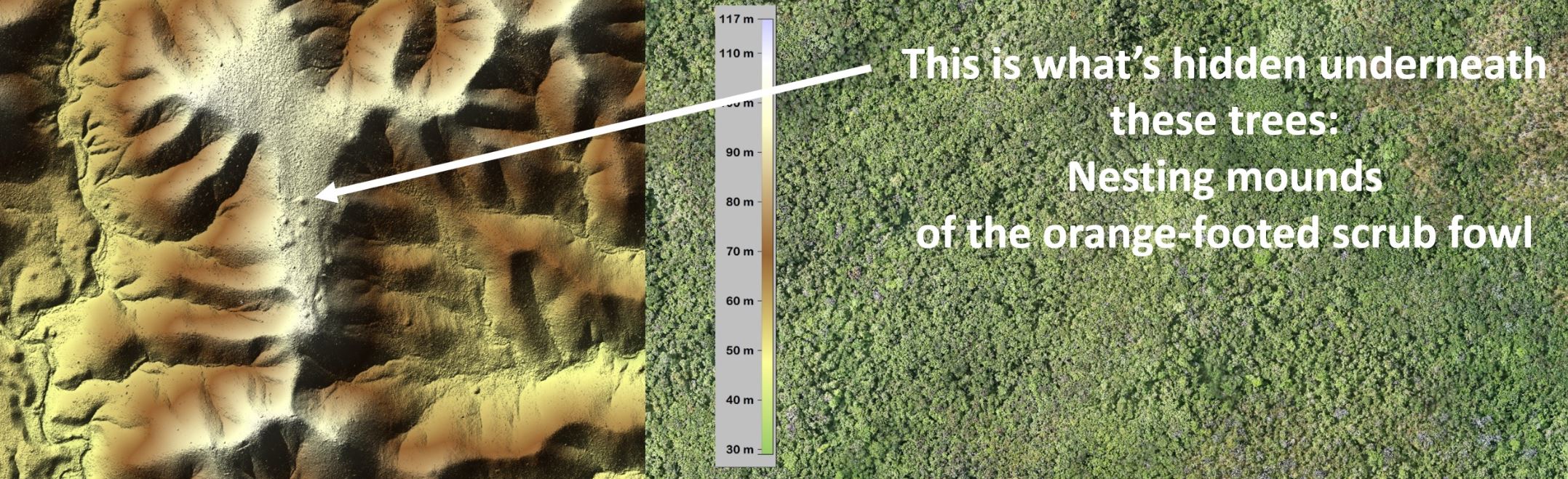
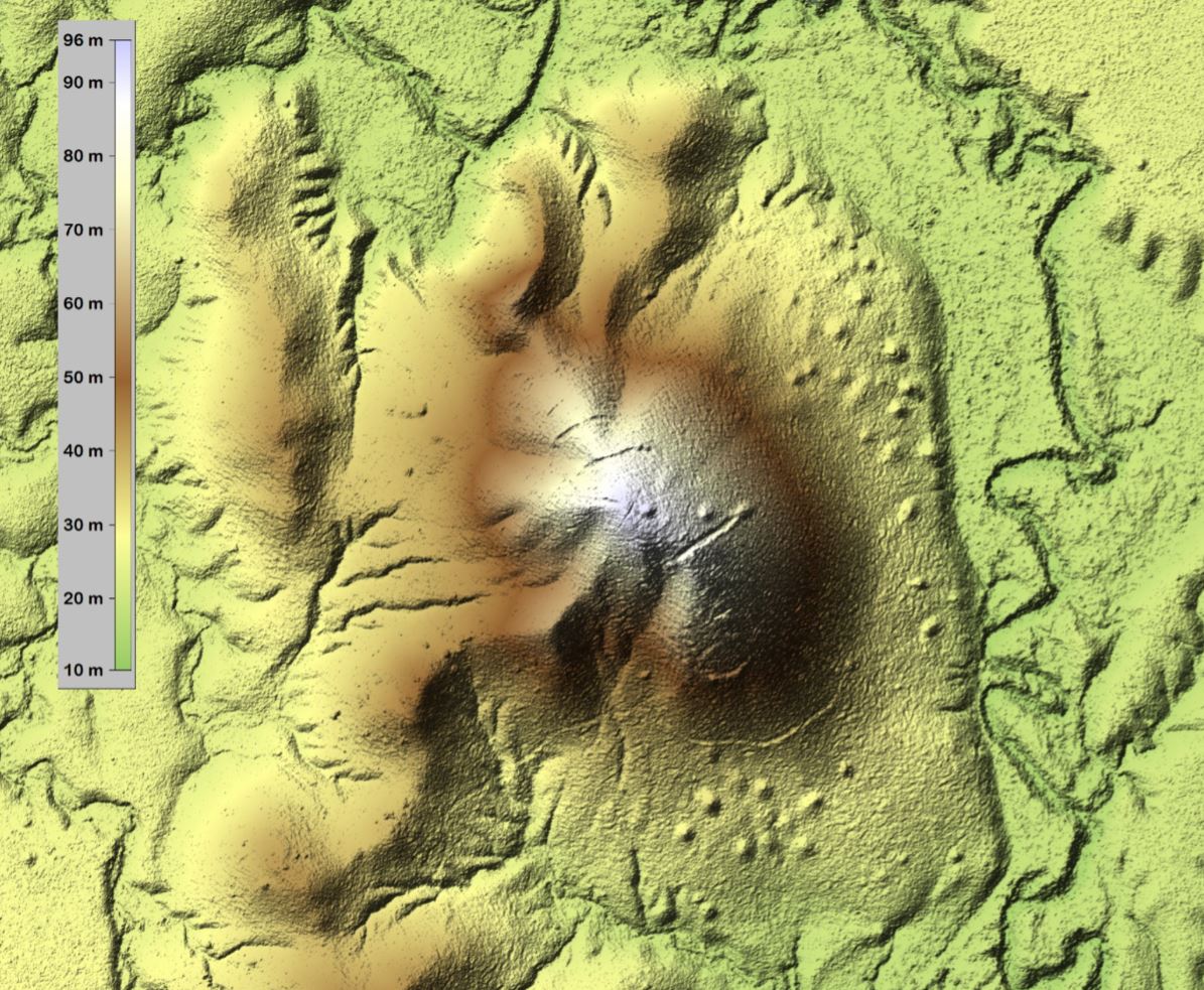
Environmental research into the rainforests of Cape Yorke is unearthed new insights into the hidden life of large Australian land birds which incubate eggs in large mounds of rotting vegetation.
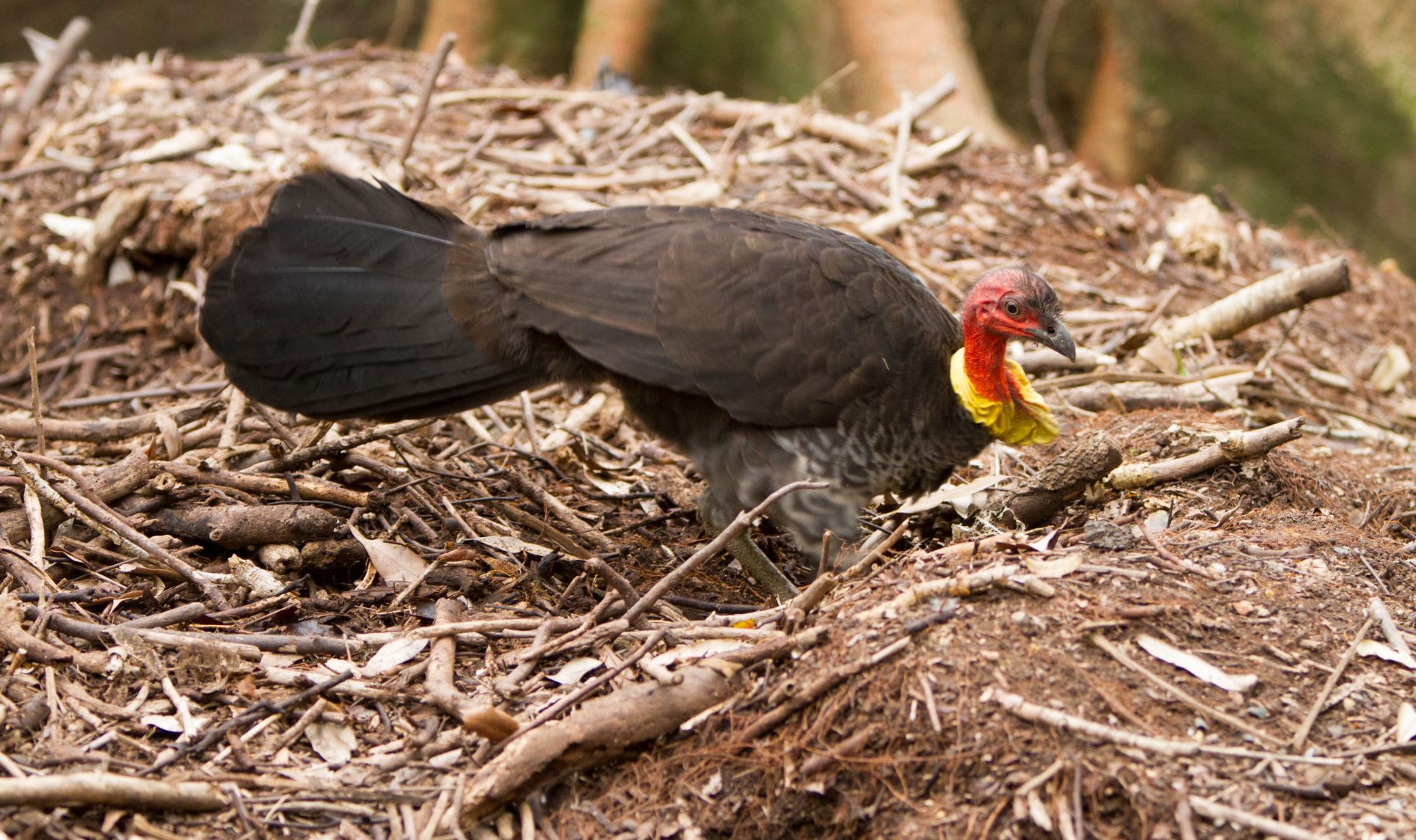
Hundreds of these large nesting mounds of megapodes (brush-turkeys and orange-footed scrub fowls) have been located by Flinders University Professor Jorg Hacker, using aircraft-mounted LiDAR (light detection and ranging).
“It’s fascinating to think an eye in the sky can strip away the rainforest with this technology to record and study the terrestrial nesting patterns of Australian Brush-turkeys, along with old mining and other activity, on remote parts of Cape Yorke Peninsula,” says Professor Hacker, who is chief scientist of Adelaide-based research institute Airborne Research Australia.
LiDAR remote sensing technology has been used in many archaeological applications around the world, he says, such as finding Mayan pyramids in Central America and trenches dug during an historic siege of Vienna in Austria.
“Now we have used our configuration of airborne LiDAR to ‘remove’ the dense vegetation of the Australian rainforest to ‘see’ what’s on the ground in high resolution when it’s otherwise almost impenetrable to the human eye as well as aerial photography.”
The aerial mapping over the remote rainforest area around the privately-funded Iron Range Research Station (IRRS) is part of a biodiversity project in the region funded by the philanthropic Maxim Foundation,which also supports Palaeontology research at Flinders University.
The research will contribute to an important dataset being compiled for the privately funded IRRS, focusing on taking measures to prepare for fire management and future natural disasters, including after the recent tropical Cyclone Trevor swept across Far North Queensland.
Maxim Foundation supporter Keith Cook, who is leading the Cape York research project, says the mapping will help IRSS researchers address many conservation questions, including how many megapode live in the important rainforest area, compared to other native species nesting elsewhere in Australia.
“By comparison, Mallee fowl nests look similar and are much easier to find in open mallee landscape, but the dense rainforest is a far different environment to study this interesting bird,” Mr Cook says.
“This will add to our knowledge of megapode activity along with other factors to help manage activity in these Cape York rainforest areas,” he says.
“We hope the results of this study will help with further research into the structure and biodiversity of the rainforest of Cape York.”
Further aerial mapping is planned in May-June to map the effects of the cyclone.
“Not only did we find the brush-turkey mounds by sheer coincidence, but we also found traces of historic goldmining ventures in the region,” Professor Hacker adds.
“We hope to develop software to help distinguish between the nesting mounds and similar looking piles and rocks and dirt left by miners over the past century.
The research will incorporate neural networks and artificial intelligence to identify the origin of animal and manmade activity recorded by the aerial surveillance.