Bushfire recovery from the air
Two days before Christmas 2019, a fire reached a heritage-protected bush property in the Adelaide Hills, destroying a neighbour’s house. For the next two weeks residents […]
Two days before Christmas 2019, a fire reached a heritage-protected bush property in the Adelaide Hills, destroying a neighbour’s house. For the next two weeks residents […]
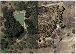
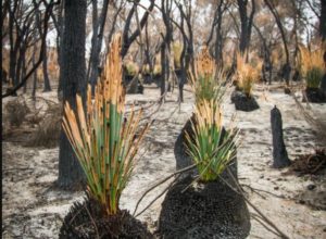
Adelaide-based Airborne Research Australia is creating free 3D high resolution maps of devastation caused by fires in the Adelaide Hills and Kangaroo Island to help communities […]
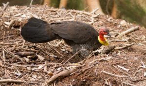
Environmental research into the rainforests of Cape Yorke is unearthed new insights into the hidden life of large Australian land birds which incubate eggs in large […]
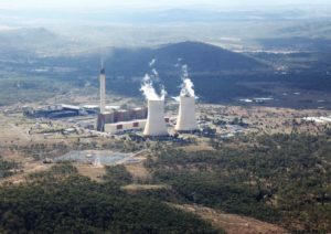
Modern coal-fired power stations produce more ultrafine dust particles than road traffic and can even modify and redistribute rainfall patterns, a new 15-year international study shows. […]
Flinders will have a prominent role when Adelaide is featured as the first in a new National Geographic television documentary series on the world’s smart cities.