As winter storms approach, scientists are gathering data to help combat coastal erosion from two new wave buoys located off South Australia’s leading beach resort Robe in the state’s South East.
The project, a collaboration between Flinders University, the District Council of Robe and the South Australian Research and Development Institute (SARDI), the research arm of Primary Industries and Regions SA, extend the existing network of wave buoys located along Adelaide’s metropolitan coast (Semaphore and Brighton) and Kangaroo Island.
The network will provide long-term monitoring with real-time wave data to better understand coastal processes in the SA region, and help predict the future of the state’s coastlines.
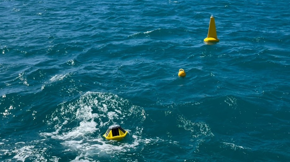
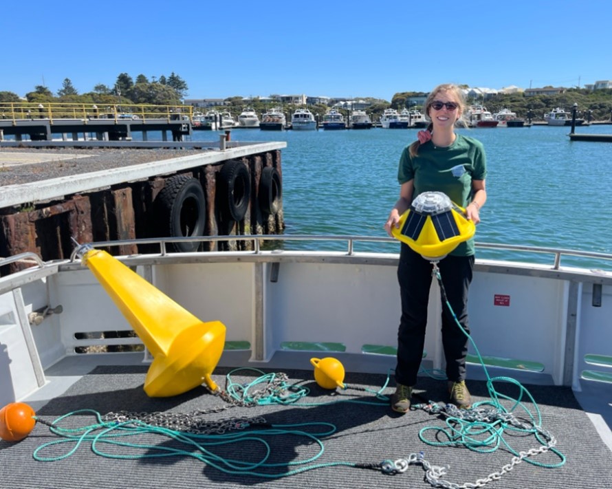
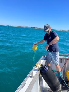
Flinders University researchers, led by a team comprising Ms Charlotte Uphues and Associate Professor Graziela Miot da Silva, SARDI oceanographer Dr Paul Malthouse and rock lobster fisher Paul Regnier deployed two Spotter wave buoys off the coast of Robe in December.
The two wave buoys were strategically placed in a line to observe the wave transformation from offshore to the nearshore. Access to the data is freely available to the public through the www.sawaves.org website.
“The South Australian coast faces some of the largest swells in the world produced in the Southern Ocean. This highly energetic environment causes significant coastal sand movement at times, often resulting in coastal erosion,” says Flinders PhD candidate Charlotte Uphues, from Flinders University’s Beach and Dune Systems (BEADS) Lab.
“Many coastal communities in South Australia face beach erosion issues that affect coastal infrastructure, tourism, and the environment.
“One of the communities is the District Council of Robe, which is centrally located on the southeast coast of South Australia and has faced increasing erosion problems, especially in the last five years.”
Sand nourishments costing up to $50,000 a year is the main way the council counteracts erosion of Robe’s sandy beaches.
The deployed buoys are Sofar Spotter metocean buoys, that collect and transmit accurate ocean data such as wave height, period and direction, wind speed and direction, sea surface temperature, and barometric pressure in real-time via cellular means.
The intent of the research is to find better ways to manage this cost and to mitigate the risk to private and public assets on the coastline.
The provision of accurate wave data is critical to improve understanding of variations in the hydrodynamic processes that shape coastlines, to inform best coastal management practices, drive the development of marine industries, and to promote and support tourism.
“For the Robe region, and indeed for much of South Australia, there has been a significant gap in wave information available to researchers, managers, developers, and policy makers because the nearest wave buoys are more than 200 km away, off the coast of Kangaroo Island and Portland in Victoria,” adds Flinders University Associate Professor Graziela Miot da Silva.
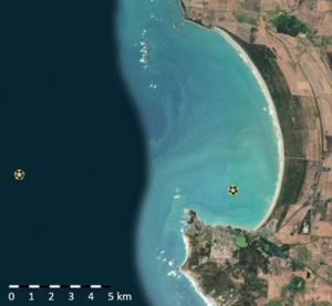 BEADS Lab lead Professor Patrick Hesp says the project has also been supported by local lobster fisherman and former president of the Professional Fisherman’s Association Paul Regnier, who provided his fishing boat for the deployment of the two wave buoys about 8 km offshore and the other one about 1.5 km from the main beaches of Robe in the inner bay.
The real-time wave data collected by this project will allow for the development of validated data-assimilating wave- and morphodynamic models to predict future changes in South Australia’s coastline, including climate change and sea level rise.
As part of her PhD research, Ms Uphues will use the data to set up a coupled wave-flow model with morphology to better understand the driving factors that shape Robe’s coastline and to make predictions as to how Robe’s coastline will develop in the future.
The model can then be used to develop coastal management practices, including sediment nourishment practices to maintain Robe’s beaches.
Access to real-time wave data not only aids research, but it also provides valuable information necessary for informing daily marine operations, such as dredging, navigation, and sea conditions for commercial and recreational fishermen, and search and rescue, and water-based research and monitoring programs.