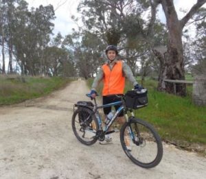
A Flinders student has used geo-mapping technology to produce the first comprehensive, interactive map of one of South Australia’s iconic horse riding trails.
David Phillips, an under-graduate student of Geographical Information Systems at Flinders University, spent ten days riding his bike along the 269-km Kidman Trail, during which time he recorded the route, a detailed elevation profile, and a comprehensive assets database for the trail.
The data gathered by Mr Phillips, captured using handheld GPS, a smartphone, and a standard compass, is now contained in a web based app which can be accessed on any device with internet access.
The app, which was created as part of his major project and will be managed by Horse SA, also crucially allows people using the trail to log on and report trail problems or suggest new trail facilities.
That will provide Horse SA with an unprecedented amount of information to manage the Kidman Trail in line with their management plan for the route.
The final product comprises of three elements, an interactive digital map of the trail, an online system through which horse riders can log on and report problems with the trail, and an asset management system through which Horse SA can manage trail assets and view trail problems reported by the public.
All of the data is securely stored on a server at Flinders University.
Mr Phillips said the project, and his studies at Flinders in general, had allowed him to combine his passions for digital technology and the outdoors.
“I’ve always loved the outdoors and using the latest tech, so it was a great way to bring those two passions together, and everything I’ve learned at Flinders throughout my degree.” Mr Phillips said.
“One of the most important aspects of this project is that it provides Horse SA with a powerful Geographical Information System for managing the trail.
“These systems have traditionally been too expensive for small, non-profit organisations, but the recent surge in web mapping software and capabilities are making it cheaper and more accessible than ever before.
“We used a system called ArcGIS Online and were able to collect spatial data using standard consumer tablets and smart phones, and sync the data straight back to the Flinders University servers.”
The project was arranged by Mr Phillips’ supervisor, Robert Keane, a Geographical Information Systems specialist from Flinders University’s School of the Environment.
Mr Keane said it was a great capstone project to highlight his skills.
“David worked with a real client to solve a real problem that has real community value,” Mr Phillips said. “He had to evaluate the client’s needs, design a solution and implement that design.
“The final product, using cutting edge geo-technologies and cloud delivery systems, exceeded Horse SA’s expectations and allows them to manage the trail much more efficiently and in real-time.”
You can find more information and access the app here.

