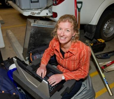
Flinders University groundwater expert Dr Margaret Shanafield is digging deep to find out how much water should be released upstream to replenish the endangered Coorong Wetlands.
Dr Shanafield, a Research Fellow from the School of the Environment, is using fibre optic cables to measure the temperature of groundwater in a regraded channel designed to carry water from Bool Lagoon into the Ramsar-listed Coorong wetlands.
The Coorong is a five kilometre wide body of water that stretches from the Murray Mouth down the south east coast of South Australia for about 110 kilometres, providing an important sanctuary for many species of birds, animals and fish.
In the past, groundwater naturally fed the wetlands and flowed into the Coorong until a series of drains were built for agriculture and pasturing purposes, altering and reducing the groundwater flow which changed conditions in the wetlands.
As part of the study, Dr Shanafield and her colleagues at the Flinders-based National Centre for Groundwater Research and Training have installed fibre optic cables in the subsurface of the channel to measure the temperate across 20 metres of streambed, with the data used to construct a 3D computer model of heat transport and flow.
Dr Shanafield said the heat measurements can be used to estimate the amount of water infiltrating below the surface of different areas of the channel, thereby providing information on how much water would need to be released from Bool Lagoon in order to sufficiently replenish the water-starved wetlands.
“A percentage of water released from Bool Lagoon doesn’t make it to the Coorong wetlands because of factors including groundwater infiltration and evaporation,” said Dr Shanafield, who has just received one of Flinders University’s Vice-Chancellor’s Awards for Early Career Researchers.
“Now we’re able to see how much loss there is and also what areas of the channel have the highest infiltration rates.
“If we know how much water reaches the bottom end of the Coorong, we’ll know how much water needs to be released at the top.”
Dr Shanafield is also using a computer model to estimate the amount of surface water that becomes groundwater following an engineered experimental flood in the Colorado River channel in Mexico last month.
“In lots of ways the Colorado River is like the Murray – they’re both really important to a large population and the water in these regions has been so over-allocated that it has wreaked a lot of havoc on the two environmental systems.”
The Coorong wetlands infiltration study has just been submitted for publication in the international journal Water Resources Research.