New research has revealed that the process of ‘peopling’ the entire continent of Sahul — the combined mega continent that joined Australia with New Guinea when sea levels were much lower than today — took 10,000 years.
Sophisticated models combined recent improvements in demography and models of wayfinding based on geographic inference to show the scale of the challenges faced by the ancestors of Indigenous people making their mass migration across the supercontinent more than 60,000 years ago.
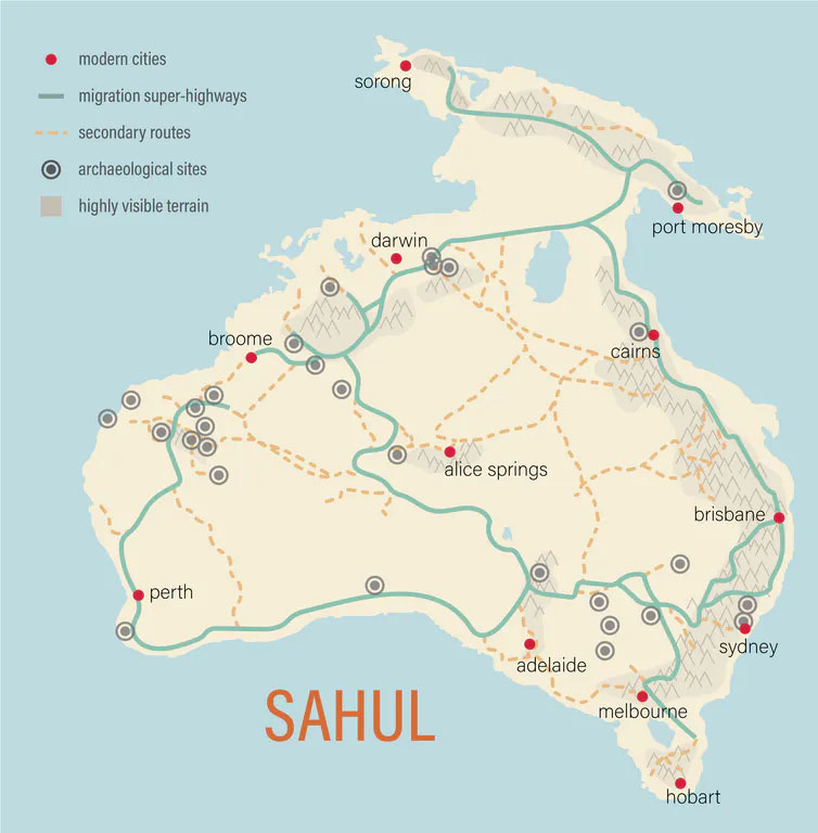
The ancestors of Aboriginal people likely first entered the continent 75,000–50,000 years ago from what is today the island of Timor, followed by later migrations through the western regions of New Guinea.
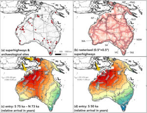
According to the new research, this pattern led to a rapid expansion both southward toward the Great Australian Bight, and northward from the Kimberley region to settle all parts of New Guinea and, later, the southwest and southeast of Australia.
The research was led by the ARC Centre of Excellence for Australian Biodiversity and Heritage (CABAH) and saw international experts in Australia and the United States collaborate to investigate the most likely pathways and the timeframe needed to reach population sizes able to withstand the rigours of their new environment.
By combining two existing models predicting the routes they took – ‘superhighways’ – and the demographic structure of these first populations, the researchers were able to estimate the time for continental saturation more precisely. The new research has just been published in the international journal Quaternary Science Reviews.
 Based on detailed reconstructions of the topography of the ancient continent and models of past climate, the researchers developed a virtual continent and programmed populations to survive in and move successfully through their new territory.
Navigating by following landscape features like mountains and hills and knowing where to find water led to successful navigation strategies. The first people of Australia soon passed along cultural knowledge to subsequent generations facilitating the peopling of the whole continent.
Yet the challenges put forth by the topography of Sahul led to a slower pace of migration. Previous models did not take into account the topographic constraints that this sophisticated model does, allowing for a more realistic estimation of the peopling of the continent.
This new work also explains the slower progress Indigenous ancestors made in reaching Tasmania, which was only made possible when seawaters across Bass Straight receded — a finding only possible by combining these model results.
The study’s lead author, Corey Bradshaw, Matthew Flinders Professor of Global Ecology at Flinders University and CABAH Models Theme Leader, says together these combined models allow for a better understanding of the archaeological and genetic data explaining the great migrations of Indigenous people in Sahul.
‘The ways that people interact with terrain, ecology, and potentially other people alter our model outcomes, providing more realistic results. Therefore, models that incorporate only demographic information without considering the resources and needs of travellers, as well as the opportunities and constraints to their travel, are likely to underestimate the timing of expansion into new regions. So, we now have a good prediction of the patterns and processes of how people first settled these lands tens of thousands of years ago.’
‘Our updated modelling shows that New Guinea was populated gradually over 5000 to 6000 years, with a focus initially on the Central Highlands and Arafura Sea area before reaching the Bismarck Archipelago in the east. The peopling of the far southeast and Tasmania is predicted to have occurred between 9000 and 10,000 years following initial arrival in Sahul.’

Professor Bradshaw says the innovative model developed by the researchers could be modified for other parts of the world to investigate the timing and patterns of initial peopling by humans.
‘Examining comparable patterns in regions of the Middle East as humans left north-eastern Africa, entry and spread into Europe, expansion across southern Asia, and movements from Alaska to South America, are all now possible using the same modelling approach.’
‘Because our model incorporates local conditions, including the spatial and temporal patterns of the land’s ability to provide food, the distribution of water sources, and topography, our migration patterns would be highly relevant when applied to other parts of the world.’
‘These results are surprising and very compelling,’ says Dr Stefani Crabtree, co-author of the study and Fellow at the Santa Fe Institute and Assistant Professor at Utah State University.
‘Our work shows that we need to keep in mind the constraints placed on travellers by the underlying geography as well as likely demographic scenarios. And as this work is based on our understanding of human movement globally, it can have massive implications for understanding migration in other places and other times. This also goes to show the power of combining computational models with archaeology and anthropology for refining our understanding of humanity.’
‘This type of work is a game changer.’
‘Directionally supervised cellular automaton for the initial peopling of Sahul ’ by Corey Bradshaw, Stefani Crabtree, Devin white, Sean Ulm, Michael Bird, Alan Willians and Frederik Saltre is published in Quaternary Science Reviews. DOI: 10.1016/j.quascirev.2023.107971
, , , , , ,

