3D aerial maps to help fire ground recovery
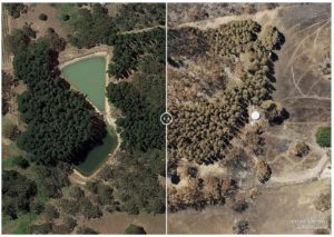
Adelaide-based Airborne Research Australia is creating free 3D high resolution maps of devastation caused by fires in the Adelaide Hills and Kangaroo Island to help communities […]
Adelaide-based Airborne Research Australia is creating free 3D high resolution maps of devastation caused by fires in the Adelaide Hills and Kangaroo Island to help communities […]